Introduction general of rivers and lakes in Phnom Penh city, Cambodia
Located in the Southeast Asia, Phnom Penh city is the capital and largest city of Cambodia, with total area of 692.46 km2. The city is situated at latitude 11º 33ʹ N and longitude 104º 55ʹ E. The population of the city is 2.1 million (13.9% of total population) with density of 3,136 people/km2 (NIS, 2019). The climate of river basin in Cambodia is influenced by the annual monsoon cycle with large spatial and temporal variability of alternating two specific seasons, the rainy season (May to October) and the dry season (November to April). The annual average temperature ranges from 21 °C to 35 °C. The annual rainfall ranges from 800 mm to 2,600 mm, with the average annual rainfall being approximately 1,225 mm, and more than 90% of precipitation occurs during the rainy season. Phnom Penh city lies partly of or within the Mekong, Tonle Sap, Bassac, and Prek Thnot Rivers’ basins. The city also consists of several wetlands/lakes, whose play an important role in floods and wastewater control of the city. These rivers and lakes offer valuable freshwater, ecosystem, supporting livelihood, and the rich cultural heritage of the people of Phnom Penh City.
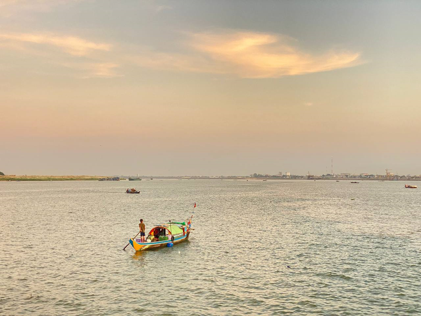
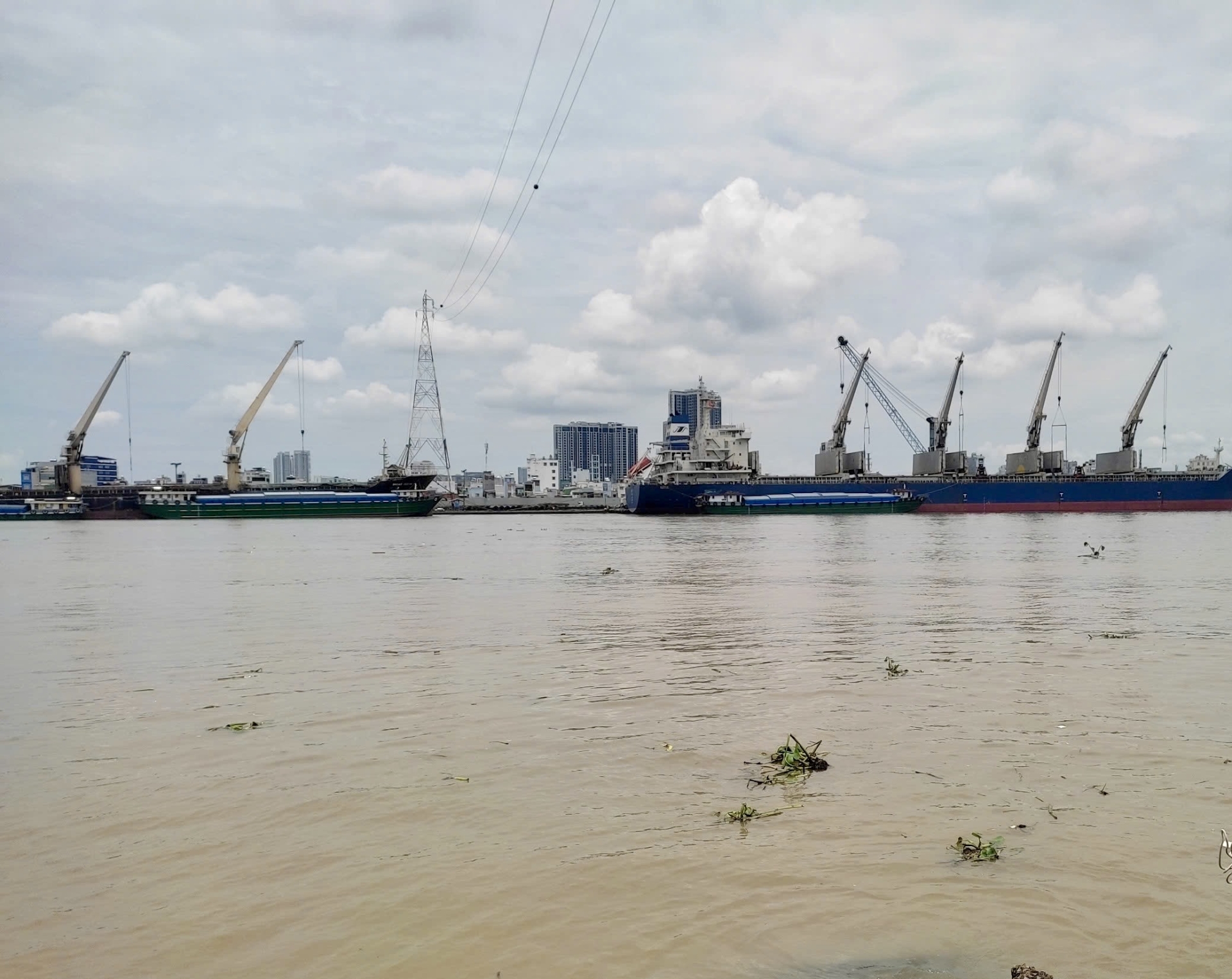
Human Activities on the Mekong River in Phnom Penh (Photo: in 2024)
1. Rivers
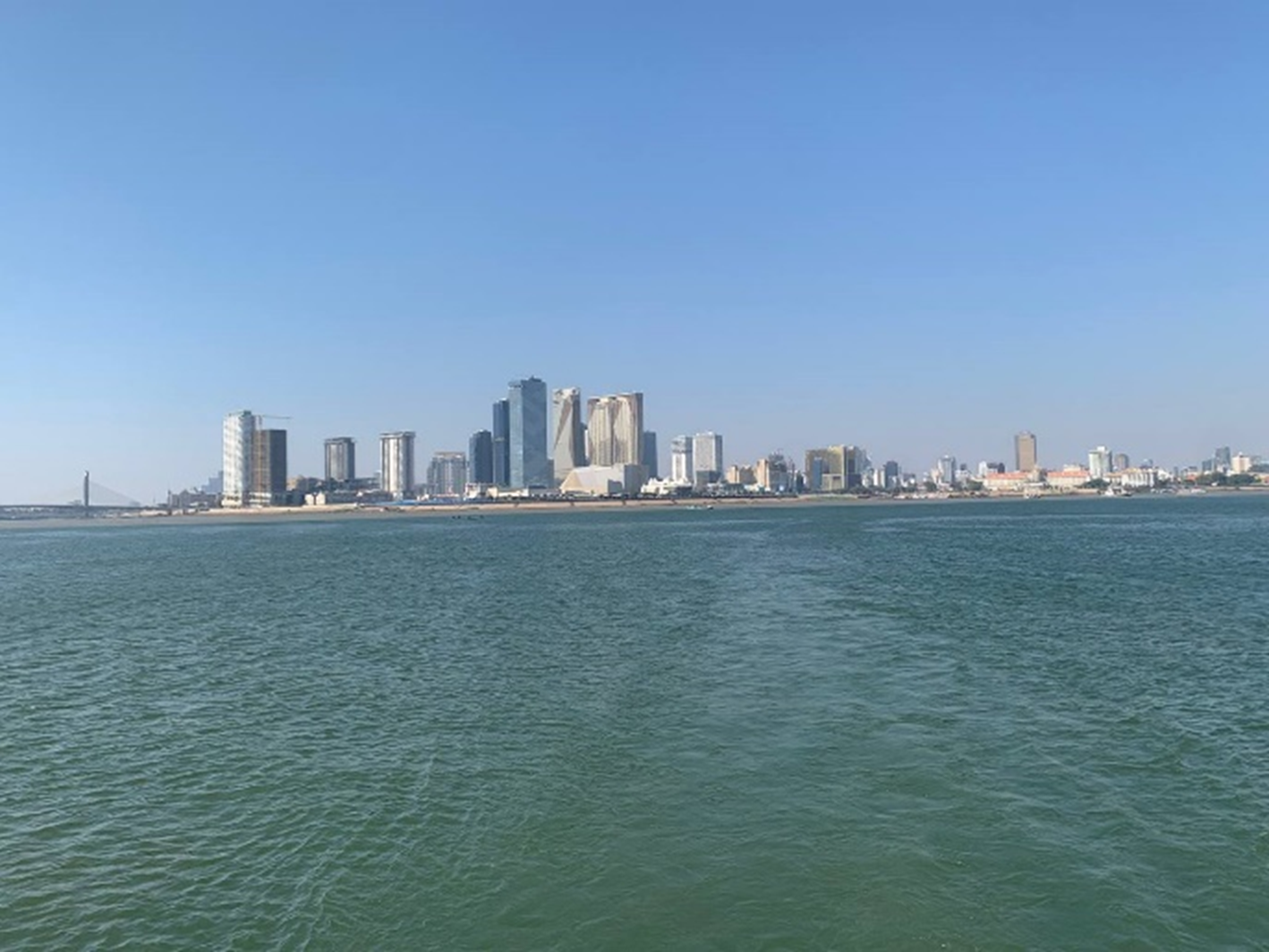
At Phnom Penh, there is a significant confluence known as the Chaktomuk Confluence, where the Mekong, Tonle Sap, and Bassac Rivers intersect. Mekong River originates in the Tangelo Mountain range of the Tibetan region of China. It flows through six countries, China, Cambodia, Lao People’s Democratic Republic, Myanmar, Thailand, and Vietnam before it enters the South China Sea in Vietnam. At the Chaktomuk Confluence in Phnom Penh city, the Mekong River is divided into the Lower Mekong River and the Bassac River. Bassac River flows southeast from Phnom Penh down to the Mekong Dalta, Vietnam. The annual water discharge of Mekong River at Chroy Changvar, Phnom Penh, was in average 368,000 Mm3/year, at which 80% of annual flow occurred during rainy season and 20% of the annual flow occurred during dry season (Sok et al., 2021). The catchment area of Mekong River at Chruy Changvar Station (at Phnom Penh) is 663,000 km2, with the distance of approximately 2 km from the exit of Tonle Sap River (Xu et al., 2020).
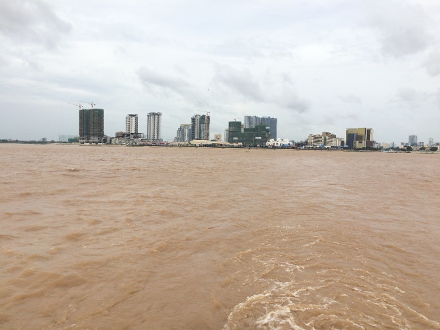
Tonle Sap River is the tributary of Mekong River, and the river connected Tonle Sap Lake (the largest freshwater body in Southeast Asia, located in central Cambodia) to the Mekong River’s mainstream. The Tonle Sap River flows 148 km southeast from Tonle Sap Lake to meet the Mekong River at Phnom Penh during the dry season. The hydrology of the Tonle Sap Lake and River are driven by the monsoonal flood regime of Mekong River (Kummu et al., 2014). This river system is unique, primarily due to the reverse flow of the Tonle Sap River between the rainy and dry seasons. During the rainy season, the river flows back from the Mekong River to the Tonle Sap Lake. This phenomenon is driven by the difference in hydraulic head between Tonle Sap Lake and the Mekong River (Lu et al., 2014). The flow of Tonle Sap River shares a contribution to the water discharge, water quality, and water related pollutant to Mekong River at Phnom Penh and the downstream, for example, 18% of water discharge, 3.7% of average annual sediment load, and 6 - 9% of nutrient load (Sok et al., 2021, 2022).
| Dry season
|
| Rainy season
|
The view of Mekong River at Chaktomuk confluence, Koh Pich, Phnom Penh (Photo: in 2024 and 2023)
The Mekong and Tonle Sap River system plays a significant role in supporting the water resources, livelihoods, and ecosystems of Phnom Penh and Cambodia. For instance, these rivers serve as the primary source of raw water for Phnom Penh’s water supply, drawing from the Tonle Sap, Mekong, and Tonle Bassac Rivers. In 2022, the water treatment plants for Phnom Penh's water supply had a capacity of 810,000 m³/day, with plans for further expansion to meet the growing demand from the city's ongoing expansion and the widening of its supply area (PPWSA, 2024).
Despite the significant contribution to the water resource supporting the city, Phnom Penh is of potential pollutant sources to the Mekong, Tonle Sap, and Bassac Rivers as the city lie on the banks of these rivers. In the northern part of Phnom Penh city is under rapid development, making the input of organic matter, nutrients, heavy metals, emerging pollutants into the Mekong River and in the Tonle Sap are expected to increase. Due to lower flow, Tonle Sap Lake and River are more vulnerable than Mekong to these contaminations. Moreover, Tonle Sap Lake could impact on the water quality of the Mekong River, particularly during dry season when Tonle Sap River flow from lake to the Mekong River. Moreover, most of the wastewater in Phnom Penh runs off directly to public receiving sources including the Tonle Sap and Mekong water streams though public sewers and open canals/drainage systems. Wastewater released from households contains 234 tons of feces, 2,335 m3 of urine and 8,154 m3 of grey water per day. Addtionally, wastewater discharged from 3000 small enterprises amounts to more than 1 million m3/day (Prak et al., 2010). While only 9% of wastewater discharge in Cambodia is properly treated before being released into natural water body (World Bank, 2017). According to the Ministry of Environment (MOE), although chemicals are widely used in the industrial sector to boost production, Phnom Penh lacks separate sewerage systems for blackwater, greywater, and rainwater. Only 5% of runoff is properly treated before being discharged. During the dry season, the concentration of sewage and pollutants in the sewerage systems and receiving water bodies becomes particularly high due to limited water available for dilution. The Mekong and Bassac Rivers near Phnom Penh show contaminant levels of significant contaminations below detectable limits, indicating minimal impact from local anthropogenic activities. (Ongley, 2009). However, the city still contributes to changes in water quality downstream
2. Lakes
Phnom Penh city consists or is surrounded by several wetlands/lakes such as Tamouk Choeung Ek, Tumpun, and Trabek Lakes. These lakes act as important natural wastewater treatment which is used for wastewater management of receive discharge from Phnom Penh City. These lakes receives about 90% of city’s wastewater, and the remaining 10% is directly released into the Mekong River (Bravo de Guenni et al., 2024). Under the rapid urbanization, part of these lakes has been undergoing land reclamation to be transformed into residential and business areas as part of the city's development.
Tamouk lake is located in the northwestern part of Phnom Penh, between 11°36.6' - 11°39.6' North latitude and 104°43.2' - 104°51' East longitude. The lake covers the border of Phnom Penh and Kandal Province with a total area of 24 km2. The water depth is 3.0 - 4.5 m in the dry season and rises to 5 - 7.5 m in the rainy season. This lake is the floodplain lake of the Mekong and Tonle Sap Lake and urban sewage lake. Pollutants in Tamouk lake may come from aquaculture farms around the lake and Phnom Penh’s wastewater, which was conveyed by two urban canals and discharged to the lake body by two pumping stations.
![]()
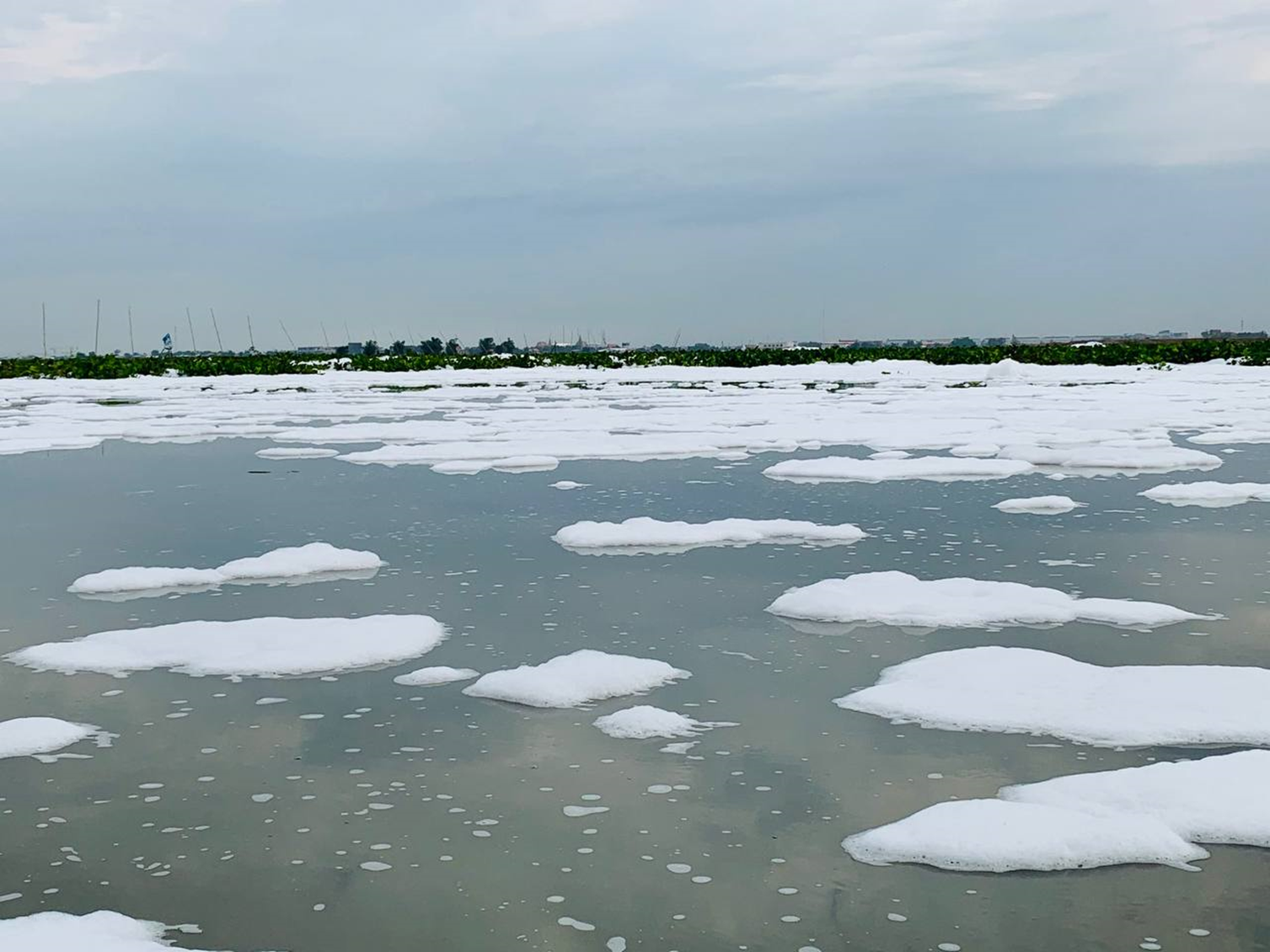
Tamouk Lake, flood and sewage Lake, at the northern of Phnom Penh (Photo: 2021)
Choeung Ek lake is located at the center of the city and lies between 11°27' - 11°31' North latitude and 104°54' - 104°56' East longitude. The surface area of the lake varies between 13 km2 in the dry season and 20 km2 in the rainy season. Choeung Ek Lake, which receives 80% of the sewage water from the city along with untreated effluent from 3,000 small and large-scale industrial enterprises through existing combined drainage pipes/channels. Wastewater effluents from the two wetlands together with industrial waste are then pumped at 15 m3/s from Tumpun lake (47.5 ha surface area) and 8 m3/s from Trabek lake (35 ha surface area) (Bravo de Guenni et al., 2024). Some of wastewater from Cheung Aek Lake is discharged to Prek Thnot River at Takhmao Bridege, and then flow to the outlet at Bassac River. The lake acts as a natural wastewater treatment area for the city and for the water before reaching the Bassac River and downstream of city. Moreover, Choeng Ek lake also plays a role as extensive peri-urban community that uses the wetland for fishing and agricultures (Irvine et al., 2015). Swamp area, seasonal land area and permanent water body in the lake have been used by the people for the cultivation of aquatic plants and animal husbandry and fisheries.
![]()
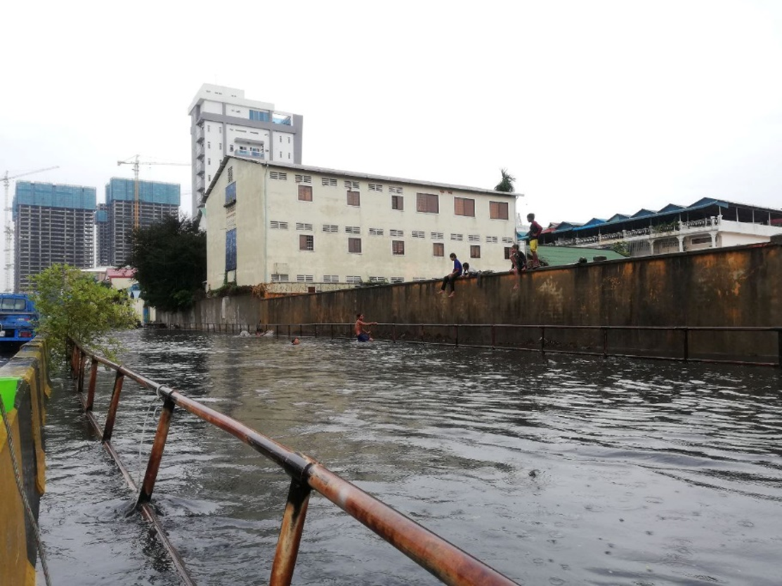
The open drainage and sewerage canals after raining in Trabek wetland area, Phnom Penh (Photo: in 2022)
The aging and fragile state of Phnom Penh's sewage and drainage systems, which has contributed to the environmental deterioration of living conditions, river and lake system. To address these issues, the Choeung Ek Sewage Treatment Plant was constructed in 2022 and completed in November 2023 with the initiative by the government of Cambodia and its collaborative partners. The plant, with a treatment capacity of 5,000 m³/day, utilizes the Pre-treated Trickling Filtration method (JICA, 2019). Additionally, other wastewater treatment projects are currently being considered following the national strategic and development plans.
Overall, the urban lakes and rivers of Phnom Penh are under significant pressure from wastewater, anthropogenic activities, and rapid urbanization. However, improvements are anticipated with the implementation of natural resource management and environmental protection plans established by the government, which aim to mitigate these impacts and restore the quality of water bodies in the city.
References
Bravo de Guenni, L., Lenczewski, M., Mallow, S. V., & Solanki, S. (2024). Assessing Water Quality Spatial Heterogeneity from Multiple Pollution Sources in the Boung Cheung Ek Wetland, Phnom Penh, Cambodia. Water, 16(1), Article 1. https://doi.org/10.3390/w16010004
Irvine, K., Sovann, P., Suthipong, S., Sothea, K., & Eliyan, C. (2015). Application of PCSWMM to Assess Wastewater Treatment and Urban Flooding Scenarios in Phnom Penh, Cambodia: A Tool to Support Eco-City Planning. Journal of Water Management Modeling. https://doi.org/10.14796/JWMM.C389
JICA, J. I. C. A. (2019). Preparatory survey report on the project for sewage system development in the Phnom Penh Capital City in the Kingdom of Cambodia. Department of Public Works and Transport, Kingdom of Cambodia. https://openjicareport.jica.go.jp/pdf/12335048_01.pdf
Kummu, M., Tes, S., Yin, S., Adamson, P., Józsa, J., Koponen, J., Richey, J., & Sarkkula, J. (2014). Water balance analysis for the Tonle Sap Lake-floodplain system. Hydrological Processes, 28(4), 1722–1733. https://doi.org/10.1002/hyp.9718
Lu, X., Kummu, M., & Oeurng, C. (2014). Reappraisal of sediment dynamics in the Lower Mekong River, Cambodia. Earth Surface Processes and Landforms, 39(14), 1855–1865. https://doi.org/10.1002/esp.3573
NIS. (2019). General Population Census of the Kingdom of Cambodia 2019. Ministry of Planning, Kingdom of Cambodia. https://www.nis.gov.kh/nis/Census2019/Provisional%20Population%20Census%202019_English_FINAL.pdf
Ongley, E. D. (2009). Chapter 12—Water Quality of the Lower Mekong River. In I. C. Campbell (Ed.), The Mekong (pp. 297–320). Academic Press. https://doi.org/10.1016/B978-0-12-374026-7.00012-7
PPWSA, 2024. Phnom Penh Water Supply Authority website. Accessed on: September 5th, 2024. https://www.ppwsa.com.kh/en/index.php?page=service-coverage
Prak, P. R., Koch, S., & Chea, V. (2010). Wastewater production, treatment and use in Cambodia. Cambodia: UN-Water. https://www.ais.unwater.org/ais/pluginfile.php/501/mod_page/content/87/report_cambodia.pdf
Sok, T., Oeurng, C., Kaing, V., Sauvage, S., Kondolf, G. M., & Sánchez-Pérez, J. M. (2021). Assessment of suspended sediment load variability in the Tonle Sap and Lower Mekong Rivers, Cambodia. CATENA, 202, 105291. https://doi.org/10.1016/j.catena.2021.105291
Sok, T., Oeurng, C., Kaing, V., Sauvage, S., Lu, X., & Pérez, J. M. S. (2022). Nutrient transport and exchange between the Mekong River and Tonle Sap Lake in Cambodia. Ecological Engineering, 176, 106527. https://doi.org/10.1016/j.ecoleng.2021.106527
World Bank. (2017). Urban development in Phnom Penh. Cambodia: World Bank Group. https://documents1.worldbank.org/curated/en/286991511862455372/pdf/121692-REVISED-Phnom-Penh-Urban-report-V8-V-low.pdf
Xu, Z., Li, C., Li, A., You, Z., Yao, W., Chen, Y., & Huang, L. (2020). Morphological Characteristics of Cambodia Mekong Delta and Tonle Sap Lake and Its Response to River-Lake Water Exchange Pattern. Journal of Water Resource and Protection, 12(4), Article 4. https://doi.org/10.4236/jwarp.2020.124017


