Introduction general of rivers and lakes in Beijing city, China
Beijing is the capital of China, the political, economic, cultural, information and transportation centre of the country, and one of the largest and most developed cities in China. Beijing is located between 39°28′ and 41°05′ N latitude and 115°25′ and 117°35′ E longitude. Beijing is located in the northwestern part of the North China Plain, with the overall topography high in the northwest and low in the southeast, surrounded by mountains in the west, north and northeast, belonging to the Taihang Mountain Range and the Yanshan Mountain Range respectively, with the mountainous regions accounting for about 62% of the city's area, and with the plains predominating in the southeast.
According to the Third National Land Survey Main Data Bulletin released by Beijing in 2021, Beijing has 61,704.00 hm2 of land for waters and water conservancy facilities, of which 30.17% is river water, 0.04% is lake water, 34.52 % is reservoir water, 13.62 % is pit-pond water, 13.37 % is ditch, and 8.28 % is waterworks building land. In more detail, in Beijing in 2021, arable land is 93,547.90 hm2, garden land is 126,274.55 hm2, forest land is 967,628.62 hm2, grassland is 144,460.44 hm2, wetland is 3,107.98 hm2, land for towns and villages and industrial and mining land is 313,643.87 hm2, land for transportation 49,281.38 hm2, water and water conservancy facilities land 61,704.00 hm2.
Beijing has a warm temperate semi-humid continental monsoon climate, with hot and rainy summers, cold and dry winters, and short spring and autumn seasons. The average annual temperature is 10 to 12℃, with January temperatures ranging from -7 to -4℃ and July temperatures ranging from 25℃ to 26℃. The average annual rainfall is 600 mm, with 75 % of the annual rainfall occurring in the summer months of June and August.
1. Rivers
The city is home of 425 rivers, with a total length of 6,413 km, dividing into five major river basins including the Chaobai, the Jiyun, the Yongding, the Beiyun, and the Daqing. Of these, the Chaobai system is the longest (1,248.14 km length), and the Jiyun system is the smallest (237.62 km length) (Song et al., 2024).
The Yongding River
The Yongding River is the largest river in Beijing and is known as the ‘Mother River’ of Beijing. The Yongding River basin is located at 112°15′E~117°10′E, 38°51′N~41°13′N, with a total basin area of 47,000 km2. The Yongding River flows through a total of 33 counties (districts), of which the watershed area of Hebei Province is 18,000 km2, the watershed area of Shanxi is 18,000 km2, the watershed area of Inner Mongolia is 0.5 million km2, and the watershed area of Beijing is 0.3 million km2, and a total of 33 counties (districts).
The upper reaches of the Yongding River (above Guanting Reservoir) cover an area of 43,000 km2, with mountainous areas accounting for 80% of the total, and the elevation is generally 500-1,000 m. The lower reaches of the Yongding River Basin (from Guanting Reservoir to the exit of Cuibandingying, Daxing District, in Beijing) cover a basin area of 3,168 km2, accounting for 6.7% of the total, with a length of the river of 184.79 km.
The average rainfall in the Yongding River basin is about 420 mm per year, but the inter-annual variation is very large, with a minimum of 200 mm and a maximum of 1,400 mm, which results in the phenomenon of rivers breaking down during the dry season and flooding during the flood season, or droughts or floods in successive years in the region. From 2005 to 2014, the hydrological situation in the upper reaches of the Yongding River Basin changed as a result of human activities, causing the Yongding River to become a seasonal river, with an average of 121 days of dryness in the main sections and 316 days of cut-off, and the average runoff in the Yongding River Basin declined year by year, leading to a series of ecological and environmental problems. At the same time, the Yongding River is also blocked by multi-level weirs and dams, which reduces the vertical circulation of the water body and severely destroys the river's biological habitats.
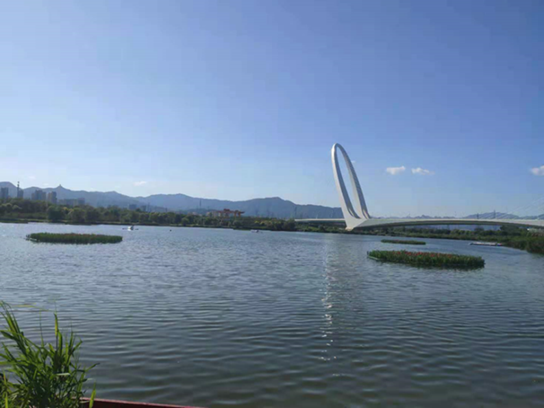
Fig: Yongding River
The Chaobai River
The Chaobai River originates in the northern mountains of Yanshan and flows through a total of 15 cities (districts and counties), with the main areas being Guyuan County, Chicheng County, Fengning Manchu Autonomous County, Luanping County, Dafang Hui Autonomous County, Sanhe City, and Xianghe County in Hebei Province. Also included are Beijing's Yanqing, Huairou, Miyun, Shunyi and Tongzhou districts, as well as Tianjin's Baodi, Binhai New District and Ninghe District. The Chaobai River Basin has an important ecological location, being an important water source for the Beijing-Tianjin-Hebei metropolitan area, a national key control area for soil and water conservation, and one of the five wind and sand destruction zones in Beijing, which is one of the most identified sites in the master plan. The Chaobai River basin covers an area of 13,846 km2, currently in the basin, with forests, grasslands and arable land accounting for 98% of the total area. The Chaobai River consists of two tributaries, the Chaonan River and the Baihe River, with the confluence located in the Miyun Reservoir (Wang et al., 2003).
The Chaobai River Basin is divided into 136 sub-basins, of which 53 are in the Chaonan River Basin and 83 in the Baihe River Basin. The terrain is predominantly mountainous, high in the northwest and low in the southeast. The climate is temperate and semi-humid monsoon with an average annual precipitation of 488.9 mm. It generally decreases from south-east to north-west, with June-August precipitation accounting for about 65 to 75% of annual precipitation (Wang et al., 2005, Zhou et al., 2016). The Chaobai River Basin plays an important role in ensuring water supply, ecological protection and environmental support (Li et al., 2021).
As of 2017, the population density around the Chaobai River Basin is 100 people, which is about 1,500 people per square kilometre (Yao et al., 2017). With rapid urbanisation and strong anthropogenic disturbances, the Chaobai River has experienced a number of environmental problems, such as dry climate, over-utilisation of water resources, reduced runoff, rapid expansion of urban and rural settlements and mining areas, severe soil erosion and frequent dust and sand events (Yang et al., 2019). As a result, the regional ecological security of the Chaobai River is facing serious threats.
The Jiyun River
The Jiyun River is one of the major rivers in the northern system of the Haihe River Basin, bordering the Luan River in the east, the Chaobai River in the west and the Bohai Sea in the south, and spanning the three provinces and cities of Beijing, Hebei and Tianjin, with a watershed area of 10,288 km2, and a total length of the river of 189 km. The main channel of the Jiyun River begins at Jiwangzhuang and flows mainly through Baodi, Ninghe and Hangu districts of Tianjin, ending at the Jiyun River tide gate in Hangu district and entering the sea via Yongding New River. The main tributaries of the Jiyun River are the Jiuhe River, the Zhouhe River and the Yixiang River. Most of the Jiyun River flows through the low-lying plains, so the river bends are developed and the water flows gently, which is a typical plain old age river.
The main channel of the Jiyun River begins at Jiuwangzhuang and flows mainly through Baodi, Ninghe and Hangu Districts of Tianjin, ending at the Jiyun River tide gate in Hangu District and entering the sea via Yongding New River. Most of the Jiyun River flows through the low-lying plains, so the river bends are developed and the water flows gently, which is a typical plains river of old age. There is a reservoir upstream to intercept the river water, and a tide gate is built at the mouth of the river to prevent seawater from backing up, and can be used to store water for irrigation during the dry season, except for the flood season when the gates are raised to release the flood water at regular intervals, and then the gates are often closed, resulting in the downstream section of the river becoming a reservoir-type waterway (Zhao, 2012).
The Jiyun River is mainly recharged by rainwater, and the flow is unevenly distributed, generally divided into the summer flood season, the overflow season and the dry season, with the summer flood season in July-August having the highest flow, and the dry season in May-June and September-February having the lowest flow. The average annual precipitation in the Jijian Canal basin is about 610-780 mm, and the rainfall is unevenly distributed throughout the year, with more rain in summer, accounting for more than 75 % of the total annual precipitation, and only 2 % of the precipitation in winter, which is also unevenly distributed from year to year (Zhao, 2012). Due to the uneven intra-annual distribution of precipitation and large inter-annual variations, spring droughts and autumn floods often occur in the region. Statistics from a previous survey of the Jijian Canal outfalls in 2011 show that the main sources of sewage in the Jijian Canal are mainly agricultural sewage, industrial wastewater and domestic sewage.
The Daqing River
The Daqing River Basin is located in the eastern foothills of the Taihang Mountains, and is an important area for water conservation and soil preservation in the Taihang Mountains. The Daqing River basin involves 81 counties (cities and districts) in four provinces and cities of Beijing, Tianjin, Shanxi and Hebei (37°37′N ~ 40°34′N, 112°57′E ~ 118°4′E), with a total basin area of about 8.1×10⁴ km². The upper reaches of the Daqing River basin are divided into two branches, the southern and northern branches. The northern branch is the Baigou River system, with major tributaries such as the Xiaoqing River, the Liuli River, the South Rejecting Horse River, the North Rejecting Horse River, the Middle Yishui, and the North Yishui. The southern branch is the Zhaowang River system, which consists of the Zaolong River (whose tributaries are the Magnetic River, the Sha River, etc.), the Tang River, the Qingshui River, the Fu River, the Cascade River, and the Tan River (Li, 2021). All the rivers converge into Baiyangdian, and the downstream connects with the Zhaowangxin River and the Zhaowangxin Canal into Dongdian, and the downstream of Dongdian enters the sea through the main stream of the Haihe River and the Duliuzhi River respectively.
The runoff in the Daqing River basin is mostly generated from mountainous areas and is unevenly distributed within the year, and the abundance and depletion characteristics of the runoff correspond to the characteristics of the precipitation, so historically, the Daqing River basin has been subjected to frequent floods and droughts. The top layer of the upper part of the basin is mostly loose loess, which is prone to soil erosion, and will transport a large amount of sediment every year, and the flood water in the basin also contains a large amount of sand. The shortage of water resources is seriously threatening the ecological environment of the Daqing River Basin (Wang, 2024). The total water resources of the Daqing River Basin are about 7 billion m³ on average over the years, of which the water resources of the mountainous areas account for 55% of the total water resources of the basin, and the per capita water resources of the basin are much lower than the national average, and it is also one of the most serious areas of water shortage in the North China Plain (Xia, 2002; Zhang, 2020).
Since the reform and opening up, the regional economy has been developing continuously, the urbanisation process has been accelerating, and wastewater, waste liquid and domestic wastewater generated by large-scale industrial activities are continuously discharged into the river, resulting in changes in the water ecological environment within the water system and increasingly serious water pollution problems.
In recent years, the substantial increase in construction land, mining, deforestation, and other land use issues have reduced the vegetation in the Daqing River Basin, and decreased the water conservation capacity. The Daqing River Basin is rich in coal resources and building materials, and long-term uncontrolled mining has led to frequent geological disasters in the upstream areas, serious soil erosion, and degradation of vegetation in the downstream areas (Wang, 2024). In 2019, the area of soil erosion in the Daqing River Basin in Beijing is 567.82km2.
The Beiyun River
The Beiyun River system originates from the southern foot of Yanshan Mountain in Changping District of Beijing, covering 10 districts (counties) in Beijing, and it is the only water system originating in Beijing, and it is also the water system with the largest plain watershed area in Beijing. The average annual temperature of the Northern Canal System is 11~12℃, the average precipitation for many years is 643 mm, the precipitation is unevenly distributed within and between years, and the precipitation is mainly concentrated in the flood season from June to September. Especially in July-August precipitation is the most, to local areas of heavy rainfall is dominated by the average multi-year runoff is 4.81×10⁸ m³ (Tong, 2009).
The main stream of the Beiyun River system in Beijing (including the Wenyu River) has a total length of 89.4 km, and the main stream of the Wenyu River in the upper reaches has a length of 47.5 km, with a watershed area of 2,478 km2. The upstream of the Beiyun River starts from Shahe Lock, on which South Shahe, North Shahe and Dongsha River converge, and from Shahe Lock to the east and southeast along Wenyu River to Tongzhou District, successively accepting Linguo, Qinghe, Bahe, Tonghui River and so on. The downstream of the Beiyun River begins at Beiguan Gate in Tongzhou District, with a main channel length of 41.9 km and a watershed area of 1,945 km2. Along the way, there are the Liangshui River and the Gangou River converging into it, and then exiting the Beijing municipal boundary at Yangwa Gate in Tongzhou District, while the Feng River and the Long River enter the Beiyun River outside the Beijing municipal boundary (Yu, 2012).
The Beiyun River basin is the most populated, industrially concentrated and urbanised basin in Beijing (Li et al., 2014), and is a typical urban river. As the main flood discharge channel of Beijing, the Beiyun River system receives about 90% of the flood discharge of Beijing city every year (Gu et al., 2017). With the continuous advancement of urbanisation, the Beiyun River system has begun to experience problems such as water quality pollution, habitat destruction, and ecological imbalance, which have seriously constrained the sustainable socio-economic development of the watershed, and the substances leading to pollution mainly come from industrial and agricultural production and residents' lives along the way, which has the typical characteristics of urban river pollution (Li et al., 2014).
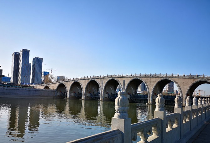
Fig: Beiyun River
The Tongzi River as the Palace moat, is an important part of the Palace, a total length of 3.5 km, the water surface width of 52 m. To the Shenwumen, the Noon Gate for the north-south axis, east, west gate for the east-west axis, divided into north-west, north-east, south-west and south-east and other four parts. Xihua Gate and Shenwumen Gate have culverts under the road surface to connect the four parts. Due to consecutive droughts in Beijing, the amount of water replenished from the upper reaches has been reduced, the problem of eutrophication in the water body has become more and more prominent, and the phenomenon of water bloom has appeared in the summer and autumn seasons, which seriously affects the normal functioning of the water body. In order to effectively improve the water quality and enhance the landscape value of the water body under the condition of existing water resources, the water quality improvement project of the Tongzi River will be implemented in phases, and 54 underwater push-flow devices are to be installed to improve the status of the water body of the Tongzi River by increasing the flow of the water body.
2. Lakes and reservoirs
In Beijing, most of the surface water resources come from artificial reservoirs (Fan et al., 2015). In this city, there are 84 reservoirs, 30 lakes, all belonging to the Yongding River, the North Canal, the Chaobai River, the Daqing River, and the Jiyun River (BWA, 2012).
Lakes
Among them, the ‘‘Six Lakes’’ are one of the most important landscapes in Beijing, including the Xihai, the Houhai, the Qianhai, the Beihai, the Zhonghai, and the Nanhai lakes (Zhang et al., 2008). The water area of Beijing city lakes is about 7.3 km2, and the water depth is generally 1.5-2.0 m (Jing et al., 2008). The Kunming Lake is the largest lake in Beijing urban area, accounting for 39% of the total lake area in the city (Zhang et al., 2021).
Information concerning 22 lakes in Beijing are presented in the table 1 (BBE, 2023).
Table 1: Information of 22 lakes in Beijing and its functions (BBE, 2023)
| Name of water body | Water column function |
| The Kunming Lake | Important Tourist Attractions |
| The Tuancheng Lake | Primary protected areas of centralised domestic drinking water sources |
| The Fuhai Lake | Important Tourist Attractions |
| The Bayi Lake | General Fish Sanctuaries and Swimming Areas |
| The Yuyuantan Lake | General Fish Sanctuaries and Swimming Areas |
| The Zizhuyuan Lake | General Fish Sanctuaries and Swimming Areas |
| The Xihai Lake | Important Tourist Attractions |
| The Houhai Lake | Important Tourist Attractions |
| The Qianhai Lake | Important Tourist Attractions |
| The Beihai Lake | Important Tourist Attractions |
| The Zhonghai Lake | Important Tourist Attractions |
| The Nanhai Lake | Important Tourist Attractions |
| The Tongzi river | Non-direct contact recreational water areas |
| The Taoranting Lake | Non-direct contact recreational water areas |
| The Longtan Lake | Non-direct contact recreational water areas |
| The Youth Lake | Non-direct contact recreational water areas |
| The ShuiDui Lake | Non-direct contact recreational water areas |
| The Red Scarf Lake | Non-direct contact recreational water areas |
| The Lotus Pond | Non-direct contact recreational water areas |
The Kunming Lake is an important landscape tour water in Beijing, located in the Summer Palace in the western part of Beijing, with a surface area of 194 hm2, which is the largest lake in Beijing, accounting for 39% of the total area of the city's lakes. It is the largest lake in Beijing, accounting for 39 % of the total area of the city (Li et al., 2007). Originally, it was a natural lake formed by the convergence of many springs in the northwestern suburbs of Beijing, and it became a part of the Royal Garden Summer Palace in the Qing Dynasty. The Kunming Lake is one of the richest lakes in terms of aquatic life species in the suburbs of Beijing. However, in recent years there has been a trend of eutrophication in the waters of Kunming Lake, especially in the southern part of the lake, where there have been outbreaks of algae growth.
The Tuan Cheng Lake, a Drinking Water Source, is located in the west of the Summer Palace, Beijing with a water surface area of nearly 30 hm2 and a reservoir capacity of about 600,000 m3, which is not only an important water supply hub within Beijing, but also an important water transmission and distribution facility for the South-to-North Water Diversion, and belongs to the Grade I Water Source Protection Zone. It plays a great role in improving the ecological environment and beautifying the urban landscape (Zhao, 2022). The Tuan Cheng Lake regulating pool bear to meet the water supply changes in water source emergency switching requirements and distribution of water, regulating pool at this stage mainly play the role of ecological replenishment of rivers and lakes to create a healthy water ecosystem, to ensure that its function as a source of drinking water, the water quality of the future operation of water quality and safety is of great significance (Zhao, 2022).
The ‘Six Lakes’ is one of the most important scenic spots in Beijing, consisting of the Xihai Lake, the Houhai Lake, the Qianhai Lake, the Beihai Lake, the Zhonghai Lake and the Nanhai Lake. In recent years, with socio-economic development, the ecosystems of the six lakes have undergone serious changes as a result of insufficient water supply, man-made disturbances, destruction of aquatic systems, shallow depths of water, lack of mobility, poor water quality and frequency of waterwaters, and slow renewal of water bodies. These conditions impair the health of the six lakes and severely impact the function of the landscape (Zhang, 2008).
The lake area in Taoranting Park includes the main lakes (East Lake, West Lake, South Lake) and Lotus Pond, all of which have an area of about 16.15×10⁴ m2, with an average water depth of 1.2-1.8 m and a water storage capacity of 24×104 m3. The lake of Taoranting Lake is closed, and its main recharge water sources are reclaimed water and south moat recharge water. According to the statistics of water replenishment in 2021, the amount of reclaimed water replenishment is 20×104 m3/yr, the amount of South Moat replenishment is 20×104 m3/yr, and the total replenishment is 40×104 m3/yr, and the rainfall runoff in the park is also directly remitted into the lake (Wang et al., 2022).
Reservoirs
The Guanting Reservoir is located at the border of Beijing and Zhangjiakou in Hebei Province, China. The reservoir has a design capacity of 4.16 billion m³ and a total area of 280 km2. Guanting Reservoir is the second largest source of industrial and agricultural water in Beijing. The Guanting Reservoir basin has a continental monsoon climate, with a regional climate characterised by short summers and long winters, an average annual temperature of 6-8°C, an average annual precipitation of 405 mm, and a precipitation that is mainly concentrated in the months of June-September, which accounts for 64-76 % of the year (Qin et al., 2021), with the phenomenon of consecutive dry years often occurring in the inter-annual distribution (Ma et al., 2023). The reservoir was once Beijing's drinking water supply, but this ended in 1997 due to declining water quality caused by industrial and agricultural pollution. In 2007, Guanting Reservoir was restored as Beijing's emergency water source due to sustainable management and protection. The Yongding River is a major tributary of the Guanting Reservoir, and is recharged by the Yang and Sang rivers upstream.
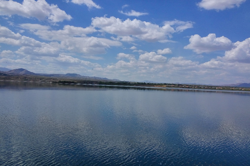
Fig: Guanting Reservoir
The Miyun Reservoir is one of the largest reservoirs in northern China, with an annual surface area of 188 km2, a watershed area of 15,788 km2 and a total capacity of 4,375 million m3. The mountainous area located in the north-west accounts for 79.47 % of the total area of the reservoir, and the plains located in the south-east account for 11.8 % of the total area. It plays an important role in supplying residential, commercial and industrial water in Beijing. The Miyun Reservoir is located in the north-eastern part of Beijing, between the mountains of Yanshan. The Miyun Reservoir has a temperate semi-moist monsoon climate with an average annual temperature of 10°C and an annual precipitation of 665 mm. Precipitation is concentrated in the flood season, and surface runoff formed by precipitation is the main source of recharge for this reservoir (Qiao et al., 2021).
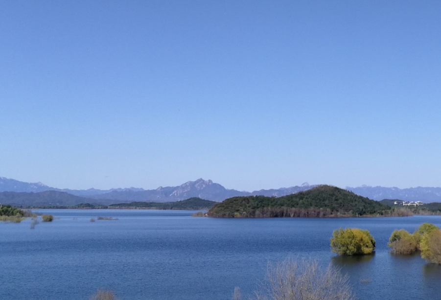
Fig: Miyun Reservior
Located in Huairou District of Beijing, Huairou Reservoir is one of the important surface water sources in Beijing. Huairou Reservoir was built in 1958, located in the upper reaches of Huaihe River at the confluence of Huaijiu River and Huasha River, belonging to the Huaihe River system, a tributary of Chaobai River. Huairou Reservoir has a total capacity of 144 million m3, with a controlled watershed area of 525 km2, of which 24.5 km2 is a primary water protection area, 84.5 km2 is a secondary water protection area, and 416 km2 is a tertiary water protection area, with a maximum discharge flow rate of 3,036 m3/s, which is a large Ⅱ type of reservoir standard.
The upper reaches of the reservoir are divided into two tributaries in the north and south, i.e. the southern branch of the Huaijiu River basin and the northern branch of the Huaisha River basin, with an area of 332 and 55 km2, respectively.The climate type belongs to the continental monsoon climate in the transition from mesothermal to warm-temperate zones, and the transition from semi-arid to semi-moist, with the longest winters, the second longest summers, and the shortest spring and autumn seasons.
The Huairou reservoir basin annual average temperature of 6 ~ 12℃, frost-free period of 140 ~ 200 d, the average rainfall for many years is 700 mm, by the southeast warm and humid airflow influence of the annual July-August rainfall, June-September precipitation accounted for about 90% of the year (Wang et al., 2012).
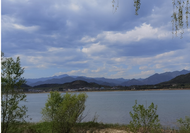
Picture: Huairou Reservoir
After the completion of the reservoir in addition to normal flood control, water storage and other functions, as an important water source and storage place in Beijing, over the years through the Beijing-Miyun diversion canal water transmission into Beijing. Since the 2015 South-to-North Water Diversion incoming water transfer into the Miyun Reservoir storage project operation, Huairou Reservoir has assumed the heavy responsibility of reverse water transfer and regulation, and while playing its own functions, it also shoulders the role of improving the water supply guarantee rate of the Miyun Reservoir, the safety of water transfer and flood control, and also plays a vital role in the development of Beijing's economic construction.
The total water resources of Beijing are 2,374 million m³ and the annual precipitation is 482 mm. The water system of Beijing includes several rivers, lakes and reservoirs, and the water bodies mainly face challenges from industrial, agricultural and domestic pollution sources (Wang et al., 2019).
References
BBE (Beijing Municipal Bureau of Ecology and Environment). Beijing Ecological and Environmental Conditions Bulletin. 2023. (In Chinese)
BWA (Beijing Water Authority), Beijing Water Resources Bulletin. China Water Resources & Hydropower Press, Beijing. 2012. https://english.beijing.gov.cn/
Fan L., Wang H, Wenli L. Administration of water resources in Beijing: Problems and countermeasures. Water Policy, 2015, 17. 563. 10.2166/wp.2014.407.
Gu X, Xu Z, Wang M, YIN X et al. Macroinvertebrates community structure and water quality assessment in the North Canal River Basin,Beijing,China.Lake Sciences, 2017, 29(6): 1444-1454. (In Chinese)
Gu Xiaoyun. Health Assessment of Urban Stream Ecosystem in the North Canal River Basin, Beijing, China. Dalian Maritime University, 2018. (In Chinese)
Jing H., Hua L., Sun C., Guo J. Evaluation and analysis of eutrophication of urban lakes in Beijing. Lake Science, 2008, 3: 357-363.
Li X, Yu X, Wu K, et al. Land-use zoning management to protecting the Regional Key Ecosystem Services: A case study in the city belt along the Chaobai River, China. Science of the Total Environment, 2021, 762: 143167.
Li X-J, Bao Z-M, Gao C-F,Mao Z-P.Zooplankton investigation and water quality evaluation in Beiyun River.Chinese Journal of Ecology, 2014, 33(6):1559-1564. (In Chinese)
Li, H.Y., Huang, Y., Wu, G. Water quality changes of Kunming Lake and pollutioncontrol methods. Water Resources Protection, 2007, (05):18-20. (In Chinese)
Li, Q.M. Study on Water System Structure and Connectivity in Daqing. Beijing Forestry University, 2021. (In Chinese)
Ma, Z.G., Li, L.L., Zhang, J.G. A Comparative Study of Changes in Watershed Area and Influencing Factors of Guanting and Miyun Reservoirs. Arid Zone Research, 2023, 40(08): 1229-1239.
Qian, X., Liang, B.C., Liu, X., Liu, X.H., Wang, J., Liu, F., Cui, B.S., Distribution, sources, and 470 ecological risk assessment of polycyclic aromatic hydrocarbons in surface sediments from the Haihe 471 River, a typical polluted urban river in Northern China. Environ Sci Pollut R 2017, 24, 17153-17165. (In Chinese)
Qiao Z, Sun S, Jiang Q, et al. Retrieval of total phosphorus concentration in the surface water of miyun reservoir based on remote sensing data and machine learning algorithms. Remote Sensing, 2021, 13(22): 4662.
Qin Z,Lei K,Huang GX,et al.Study on water balance process of GuantingReservoir under variable conditions. Journal of Environmental Engineering Technology, 2021, 11(1): 56-64.
Song T., Zhao Y., Wang M., Cheng Z. The Implementation effect of China’s river and Lake Chief System. Water, 2024, 16, 815. https://doi.org/10.3390/w16060815.
Tong, B.M. A study of spatial and temporal variations and drivers of river water quality in the Northern Canal System. Beijing: Capital Normal University, 2009. (In Chinese)
Wang L., Lv C., Y.Z., A Spatiotempral Aanlysis of Land Use Change and its Driving Forces in the Upper Reaches of the Chaobai River, North China. Progess Geogr. 2005, 24, 90–98. (In Chinese)
Wang Y, Yu X, He K, et al. Ecosystem services value based on land use change in Huairou reservoir watershed. Transactions of the Chinese Society of Agricultural Engineering (Transactions of the CSAE), 2012, 28(5): 246-251. (In Chinese)
Wang, G. S., and J. Xia. Sustainable water resources exploitation and management in Beijing, in Sustainable Water Management Solutions for Large Cities (the 23rd General Assembly of IUGG), edited by D. A.Savic et al., IAHS Publ., 2003, 293, 90-93.
Wang, G., Xia, J., Chen, J. Quantification of effects of climate variations and human activities on runoff by a monthly water balance model: A case study of the Chaobai River basin in northern China. Water Resources Research, 2009, 45(7).
Wang, M., Li, H.Q., Wang, H.N. Evaluation and Analysis of Lake Water Quality in Taoranting Park, Beijing. Journal of Green Science and Technology, 2022, 24(18): 129-133. (In Chinese)
Wang, M.M. Research on Ecological Security Assessment, Prediction and Optimized Regulation in Daqing River Basin. Hebei University, 2024. (In Chinese)
Wang, Y.X., Yang, G.F., Lin, M.S., Yang, S.T. Calculating total phosphorus in reservoirs using the satellite Landsat data. J. Irrig.Drain. Eng. 2017, 36, 105–109. (In Chinese)
Xia, J.A. Perspective on Hydrological Base of Water Security Problem and Its Application Study in North China.Progress in Geography, 2002, (06): 517-526. (In Chinese)
Yang, Y., Zheng, H., Kong, L., Huang, B., Xu, W., Ouyang, Z. Mapping ecosystem services bundles to detect high- and low-value ecosystem services areas for land use management. J. Clean. Prod. 2019, 225, 11–17.
Yao, Y., Huang, C.L., Wang, J.Z., Ni, H.G., Yang, Z.Y., Huang, Z.Y., Bao, L.J., Zeng, E.Y., 2017. Significance of 508 Anthropogenic Factors to Freely Dissolved Polycyclic Aromatic Hydrocarbons in Freshwater of China. Environ Sci Technol 2017, 51, 8304-8312.
Yu, Y. Characteristics of oxidation process and microbial response of ammonia and nitrogen in the water body of Beiyun River. Beijing: Capital Normal University, 2009. (In Chinese)
Zhang F, Liu J, Yang Z, et al. Ecosystem health assessment of urban rivers and lakes—Case study of “the six lakes” in Beijing, China. Frontiers of Environmental Science & Engineering in China, 2008, 2: 209-217. (In Chinese)
Zhang F., Liu J., Yang Z., Li Y. (2008). Ecosystem health assessment of urban rivers and lakes — Case study of “the six lakes” in Beijing, China. Front. Environ. Sci. Eng. China 2, 209–217, https://doi.org/10.1007/s11783-008-0007-y.
Zhang P., Cui X., Gao Y., Cui Q. (2021). Analysis and Research on the Pollution of Lakes in Beijing. IOP Conf. Series: Earth and Environmental Science, 791, 012174. doi:10.1088/1755-1315/791/1/012174
Zhang, Y.W. Evaluation of Groundwater Artificial Recharge Suitability in plain area of Daqing River Basin based on GIS-EWM. Jilin University, 2020. (In Chinese)
Zhao, H.L. Water ecological health assessment and ecological restoration measures study of Tuanchenghu regulating reservoir. Environmental Ecology, 2022, 4(8), 7~13.
Zhao, J.Q. Simulation Analysis of Jiyun Water Environment and Restoration Measures. Tianjin University, 2012. (In Chinese)
Zhou, X., Pan, X., Zhu, Y., et al. Research of the Mean Annual Water Balance during 1980-2013 in Chaobai River Basin. Journal of Natural Resources, 2016, 31(4): 649-657.


