Introduction general of rivers and lakes in Seoul city, South Korea
Seoul, the capital of South Korea, covers an area of 605 km2 with a population of 9.6 million, making it one of the densely populated cities in the world with 15,800 people per km2 (https://seoulsolution.kr/ko/seoul-stats). The city is the largest center of the country's economy, accounting for 23% of South Korea's gross domestic product. Located between latitudes 37.43° and 37.70° and longitudes 126.76° and 127.18°, Seoul experiences four distinct seasons. The city receives an average annual precipitation of 1,488 mm and an average annual air temperature of 11.6°C between 1910–2012 (https://data.si.re.kr/node/68). While only 3% of Seoul's land is dedicated to agriculture and 23% is covered by forests, a significant portion, 63%, has gone through urbanization (https://data.si.re.kr/data/지도로-본-서울-2013/108).
1. Rivers
The Han River penetrates Seoul (Figures 1, 2 & 3), and three main urban streams, Jungnangcheon, Tancheon, and Anyangcheon, flow into the Han River (Fig 1).

Fig 1. (a) The basin of the Han River in South Korea (green boundary). The red rectangle in (a) is redrawn in (b). (b) Seoul and the Han River. Seoul’s boundary is indicated with red line. The Han River (HR) and its tributaries, Bukhangang river (BHR) and Namhangang river (NHR), and Gyeongancheon (GA) are in blue line. The three main urban streams in Seoul, Jungnangcheon (JN), Tancheon (TC), and Anyangcheon (AY) are in green lines.
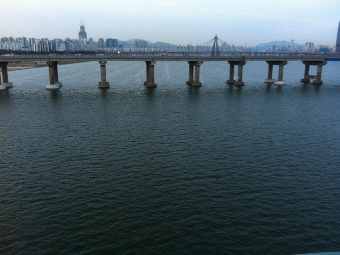
Figure 2. The Han River in a non-storm day.
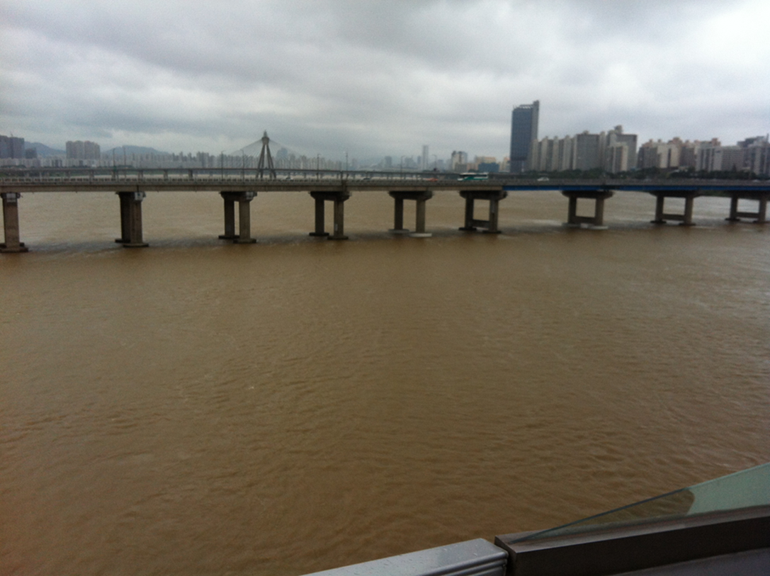
Fig 3. The Han River after a heavy rainfall during summer.
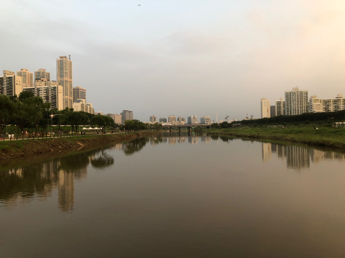
Fig 4. The Anyangcheon stream in Seoul, which flows into the Han River.
The Han River is the largest river in South Korea by volume of water discharged and drainage area. The Han River basin covers 35,770 km2 (https://hrfco.go.kr). The basin receives an average annual precipitation of 1,201 mm, and discharges 706 mm of water annually (data from 1968–2001, Bae et al., 2008). Land use/land cover in the basin is primarily forest (75%), followed by agriculture (15%) and urban areas (3%) (Lee et al., 2021a). The Han River has two major tributaries, the Bukhangang and Namhangang Rivers. These two rivers converge just before reaching Seoul (Figure 1). The Bukhangang River drains 10,744 km2, whereas the Namhangang River drains 12,394 km2. Ultimately, the Han River flows into the Yellow Sea.
The Han River has been studied for its hydrogeochemical characteristics, from its headwaters to the river mouth (Choi et al., 2019; Jin et al., 2018; Lee et al., 2021a; Lee et al., 2021b; Ryu et al., 2007; Song et al., 2017). The mean of total dissolved solids (TDS) in the mainstream were 98 mg L-1, while the levels ranged from 26 to 76 mg L-1 in the Bukhangang River and 125 to 175 mg L-1 in the Namhangang River between summer of 2000 and spring of 2001 (Ryu et al., 2007). The relatively high TDS in the Namhangang River is attributable to the presence of carbonate areas within its basin, despite the predominance of granite and gneiss in the entire Han River basin.
Dissolved greenhouse gas (GHG) concentrations increased from headwaters to the estuary (CO2: 100–9,000 μatm, CH4: 0–4,000 nmol L-1, N2O: 0–1,500 nmol L-1) (Jin et al., 2018). Discrete increases in GHG concentrations specifically within Seoul suggest that urban activities, particularly wastewater treatment plant (WTP) effluents, contribute to these elevated levels.
Δ14C of dissolved inorganic carbon in the Han River ranged from 0 to 30‰, similar to the global average (~0‰), while Δ14C of dissolved organic carbon (DOC) ranged from -55 to 0‰, lower than the global average (~50‰) (Lee et al., 2021a). The lower Δ14C-DOC values in the Han River could be due to WTP effluents from residential areas and/or the mobilization of deep soil carbon from agricultural lands upstream (Lee et al., 2023; Lee et al., 2021b).
Concentrations of rare earth elements such as Gd, La, and Sm were also investigated in the Han River. Gd ranged from 45 to 209 pmol L-1, La from 170 to 375 pmol L-1, and Sm from 24 to 50 pmol L-1 (Song et al., 2017). These levels are 17–181, 7–52, and 2–5 pmol L-1 higher than background levels, respectively, indicating anthropogenic inputs (Song et al., 2017). Gd is commonly used for medical purposes, while La and Sm are utilized as catalysts in industrial facilities (Song et al., 2017).
Concentration of lithium, which is used for batteries and medical drugs, was also 6 times higher in the outlet of the Han River (~250 nmol L-1) than in the upstream level (~40 nmol L-1), suggesting the elevated level of lithium in the coastal ecosystems due to human activities (Choi et al., 2019).
Jungnangcheon is an urban stream which flows through the northeastern part of Seoul before connected to the Han River. Its watershed covers 288 km2. Jungnangcheon receives effluent from two wastewater treatment plants with a combined average daily flow of 1,583,000 m3 (Yoon et al., 2010).
Tancheon is another urban stream which flows through the southeastern part of Seoul and connected to the Han River. Its watershed area is 316 km2. Tancheon receives effluent from three wastewater treatment plants with a combined average daily flow of 1,275,000 m3 (Yoon et al., 2010).
Anyangcheon is another major urban stream located in the southwestern part of Seoul. It flows into the Han River and has a watershed area of 286 km2. Anyangcheon receives effluent from two wastewater treatment plants with a combined average daily flow of 421,000 m3 (Yoon et al., 2010).
2. Lakes and ponds
Due to the lack of a wide plain area, Seoul has no indigenous lakes. Only two famous artificial lakes exist: Seokchon Lake and West Seoul Lake. The surface areas of the lakes are ~220,000 m2 and ~20,000 m2, respectively. Seokchon Lake was once part of the Songpa River, which no longer exists due to land reclamation. The lake water is replenished from the Han River through a water pipe. West Seoul Lake was originally a reservoir used for water purification and supply, but it has been modified to an urban park.
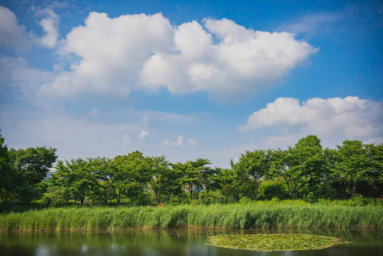
Fig 5: West Seoul park
References
Bae, D. H., Jung, I. W., & Chang, H. (2008). Long‐term trend of precipitation and runoff in Korean river basins. Hydrological Processes: An International Journal, 22(14), 2644-2656.
Choi, H. B., Ryu, J. S., Shin, W. J., & Vigier, N. (2019). The impact of anthropogenic inputs on lithium content in river and tap water. Nature communications, 10(1), 5371.
Jin, H., Yoon, T. K., Begum, M. S., Lee, E. J., Oh, N. H., Kang, N., & Park, J. H. (2018). Longitudinal discontinuities in riverine greenhouse gas dynamics generated by dams and urban wastewater. Biogeosciences, 15(20), 6349-6369.
Lee, E. J., Shin, Y., Yoo, G. Y., Ko, E. B., Butman, D., Raymond, P. A., & Oh, N. H. (2021a). Loads and ages of carbon from the five largest rivers in South Korea under Asian monsoon climates. Journal of Hydrology, 599, 126363.
Lee, S. C., Shin, Y., Jeon, Y. J., Lee, E. J., Eom, J. S., Kim, B., & Oh, N. H. (2021b). Optical properties and 14C ages of stream DOM from agricultural and forest watersheds during storms. Environmental Pollution, 272, 116412.
Ryu, J. S., Lee, K. S., & Chang, H. W. (2007). Hydrogeochemical and isotopic investigations of the Han River basin, South Korea. Journal of hydrology, 345(1-2), 50-60.
Song, H., Shin, W. J., Ryu, J. S., Shin, H. S., Chung, H., & Lee, K. S. (2017). Anthropogenic rare earth elements and their spatial distributions in the Han River, South Korea. Chemosphere, 172, 155-165.
Yoon, Y., Ryu, J., Oh, J., Choi, B. G., & Snyder, S. A. (2010). Occurrence of endocrine disrupting compounds, pharmaceuticals, and personal care products in the Han River (Seoul, South Korea). Science of the Total Environment, 408(3), 636-643.


