Introduction general of rivers and lakes in Singapore city, Republic of Singapore
The Republic of Singapore, consisting of several islands, is located in Southeast Asia and at the southern tip of the Malay Peninsula. Singapore is a city-state in Southeast Asia with a population of 5.6 million and a land area of 720 square kilometers (World-Bank, 2021). Singapore has progressively developed a vast network of about 17 reservoirs, 32 major rivers, 990 km of drains and canals, and 7000 km of roadside drains in Singapore. The Kallang River Basin receives water from three tributaries: the Geylang River, the Kallang River, and the Sungei Rochor Canal. For the Geylang River (0.53 m3/s), the Kallang River (3.63 m3/s), and the Sungei-Rochor Canal (0.35 m3/s), the flow data was averaged. In Singapore, includes more than 40 small but separate drainage basins, of which 75% have an area of less than 13 km2. The Singapore River is located within the island’s Central Region (URA, 1994). The 3.2 km waterway—from the river mouth to Kim Seng Bridge—has been Singapore's lifeline for nearly 200 years (Savage et al., 2004); its width varies from 160 m at Boat Quay to 20 m at Kim Seng Bridge. One-third of Singapore's drainage basin comprises the Singapore River, as well as the Kallang, Whampoa, Rochor, and Geylang rivers collectively known as the Kallang Basin (URA, 1994). The present demarcated start of the Singapore River is at Kim Seng Bridge, but the actual source of the river today is the Alexandra Canal (Turnbull et al., 1989). The Singapore River drains a catchment area of about 1,500 ha, and the total drainage area of the Rochor, Kallang, and Geylang is 7,800 ha (Yap, 1986). The Singapore Strait is a waterway south of Singapore which links the Strait of Melaka to the South China Sea. The entire length of the Singapore Strait is approximately 113 km and its average width is about 19 km. All rivers and streams in Singapore have been heavily channelized (Fig. 1), with several rivers dammed at the mouths to create reservoirs. Stormwater runoff is managed by subsurface storm drains and a dense network of open.
The Singapore River joins five rivers from the Kallang basin at the city's frontage and together flow into the sea through Marina Bay (Fig.2). These rivers, although small, contribute great social, economic, and environmental importance to the nation of Singapore.
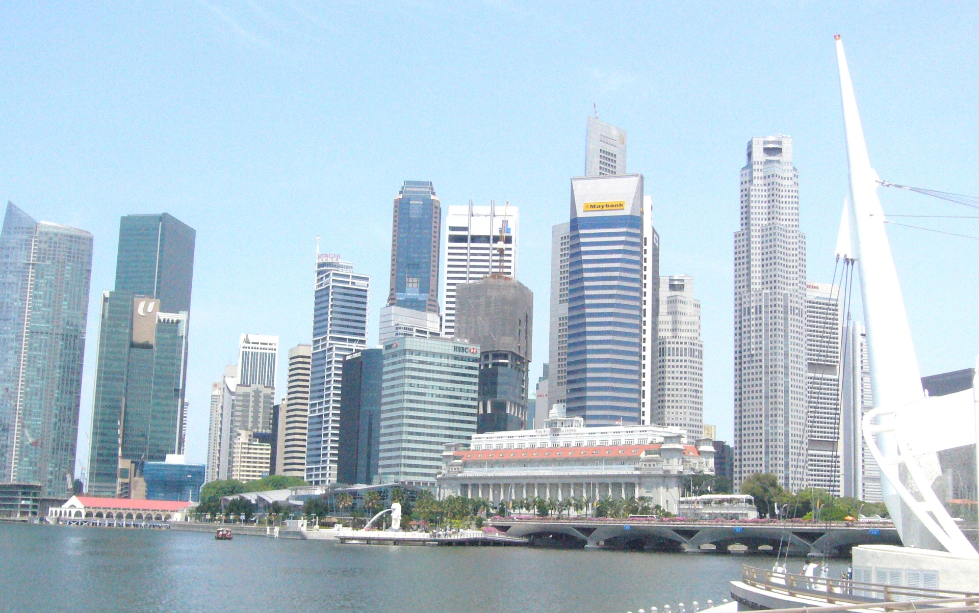
Fig. The Singapore River

Fig. 2. Merlion Park
References
Liao, Kuei-Hsien. (2019). The socio-ecological practice of building blue-green infrastructure in high-density cities: what does the ABC Waters Program in Singapore tell us?. Socio-Ecological Practice Research. 1. DOI 10.1007/s42532-019-00009-3.
Savage, V. R., et al. (2004). The Singapore River thematic zone: Sustainable tourism in an urban context. The Geographical Journal, 170(3), 212–225, p. 215. Retrieved from JSTOR via NLB’s eResources website: http://eresources.nlb.gov.sg/
Turnbull, C. M. (1989). A history of Singapore, 1819–1988. Singapore: Oxford University Press, p. 1. (Call no.: RSING 959.57 TUR-HIS).
URA. Urban Redevelopment Authority. (1994). Singapore River planning area: Planning report. Singapore: Author, p. 4. (Call no.: RSING 711.4095957 SIN)
World-Bank. (2021). Population, Total - Singapore, The World Bank Data. https://data.worldbank.org/indicator/SP.POP.TOTL?locations=SG
Yap, K. G. (1986) Physical improvement works to the Singapore River and the Kallang Basin, Paper presented at COBSEA Workshop on Cleaning–up of Urban River, 14–16 January, Singapore (Ministry of the Environment of Singapore and UNEP).
Wang, M., & Zhou, Z. (2018). Occurrence and distribution of trace levels of antibiotics in surface waters and soils driven by non-point source pollution and anthropogenic pressure. Chemosphere. doi:10.1016/j.chemosphere.2018.10.087


